£70.00 ex VAT
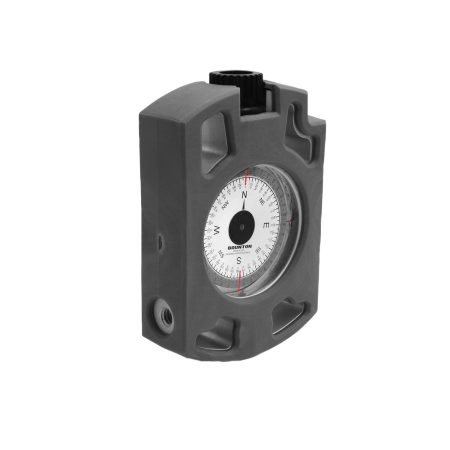
The Brunton Geo Lite transit is a well rounded, affordable geological compass clinometer for both students and professionals to undertake a number of readings and measurements in relation to geological field work. They can obtain strike and drip readings, navigation, height and slip angles and map reading.
Specifications:

7 in stock
Brunton Geo Lite Transit
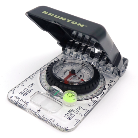
The Brunton Geo Lite Transit is a compass clinometer that is perfect for geologists, archaeologists, geographers, forestry professionals, and more. With robust, yet compact and lightweight, and the highly accurate functions expected from Brunton. Allowing users to read maps, dip and strike measurements, heights, slope angles, and more. The Geo Lite strips back the bulk weight of the regular transit models and use robust glass and plastic instead. As well as accurate magnetic needles, fluids, and plumb systems to give you an excellent all-around accurate field instrument.
The face of the Brunton Geo Lite transit displays an azimuth compass dial. Running from 0˚ to 360˚ on the outer ring, whereas the inner ring displays readings in quadrants. Furthermore, a gravity operate clinometer is also present along with a bubble level, so as to ensure accuracy when taking readings. The instrument features a toolless declination adjustment feature, eliminating the need for small keys that are often lost.
The mirror doubles as a lid to protect the compass but also acts as a sighting mirror so that you can perform triangulation or take height readings. In addition, a small hinge clinometer is present which provides you with the option to take dip and strike measurements in a single action.
Usability
Many of the features of the compass are similar to other brands on the market. Therefore, it is fairly easy to pick up and use for most. These include the overall design and layout of the compass and its operation. In addition, the toolless declination removes the need for a small key. Instead, you simply pinch the capsule from above and below, right in the center. Whilst holding the rest of the compass from the edge, and twist. This inner dial of the compass will move in the direction you are twisting. You simply set the declination to the desired reading and you are then ready to perform your mapping.
Conclusion
Overall, this is an excellent compass to use with all the features students and professional geologists will require. Particularly while undertaking fieldwork or geological mapping. Whether it be for an academic project, mineral exploration survey, or geoengineering. It will allow for directional readings, height, slope, dip, and strike. Either in the classic method or Clar method. Robust for field use and comes with the Brunton name and quality assurance.
Instruction Video
